
Katoomba to Bowral walk. April 11-17, 2017.
218km (6524m ascent; 6889m descent).
Katoomba – Black Range – Whalania Heights – Uni Rover trail – Batsh Camp – Millnigang Ridge – Colong Stock route – Wollondilly – Wanganderry Pass – Bowral
I had a few days free thanks to school holidays. My work is in an excellent jazz music school in Sydney and we had nothing on during the break. I took the chance to go for a walk. I like walking and I like holidays, so what better than a walking holiday? I’d previously walked Mittagong – Katoomba, a classic walk in the Southern Blue Mountains before, almost twice. The ‘almost’ time I was turned back near the end by a flooded Coxes River and had to fly out of Yerranderie to get out. This time I decided to start at Katoomba and end at Bowral in the Southern Highlands, mainly because it seemed a nicer place to finish than Mittagong and has a good bakery right near the station. Here’s a trip report for my Katoomba to Bowral walk. Warning: like the trip itself, this report contains some cursing.
Day One: Six Foot Track
31km; 1261m up, 1233m down
I stayed in a motel in Katoomba on Monday night for an early start Tuesday. Set off at 6am through quiet and chilly streets. Stopped briefly at a supermarket in town, mainly looking for gloves, which I’d left at home. They didn’t have anything useful, but not to worry.
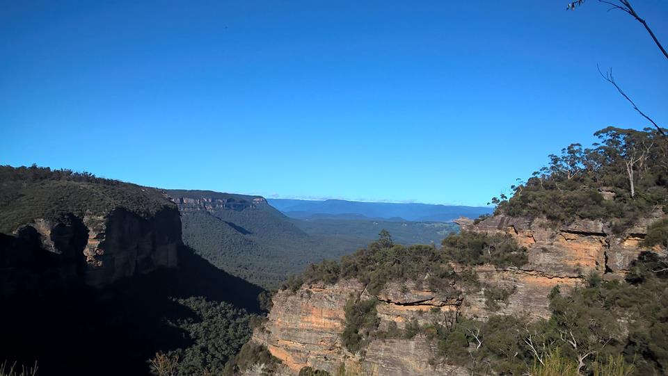
I walked that first day along the Six Foot Track route over the Megalong Valley and up into Black Range. I made the Coxes River by late morning and paused at the nearby camping area for an early lunch taking advantage of the picnic tables and tank water there. I remembered the first time I’d walked the Six Foot Track, and that then it had taken a full day to walk to that point. Now I can’t think how you could possibly stretch those few km into a full day, nor why you’d want to camp at that place. People can drive there via fire trails from Jenolan Caves Rd or Great Western Hwy so there always seem to be car or, even worse, blokey 4wd campers there complete with booze and loud music. This time didn’t disappoint. There was a little gaggle of dickheads with ‘doof-doof’ music blaring even as they packed up to leave. At least they seemed to be taking their garbage with them. Rule of thumb: treat the bush like a ‘quiet carriage’.
The first big climb of the walk was from the Coxes River up to the top of Black Range broken by a short steep downhill and false flat near Allum River. I passed the Allum River campsite about 2pm, pausing only to get water for that evening’s dry camp up on the range. I set up camp about 4:30pm near the turn off to Moorara Boss Firetrail. The night was clear and still, chilly but spectacularly lit by a giant full moon.
Day 2: Hellgate Gorge
25km; 1263m up, 1108m down.

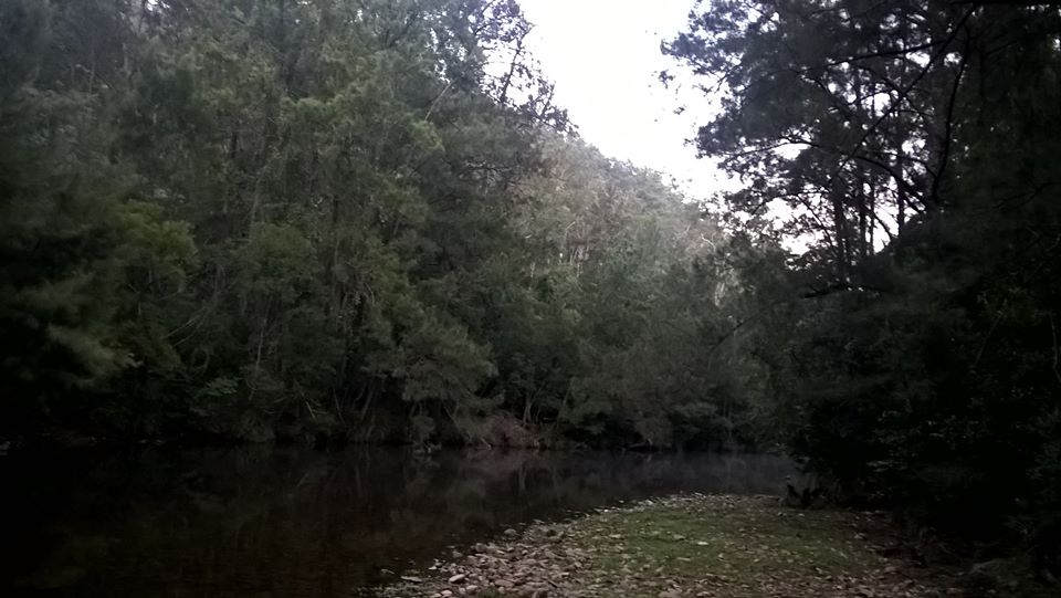
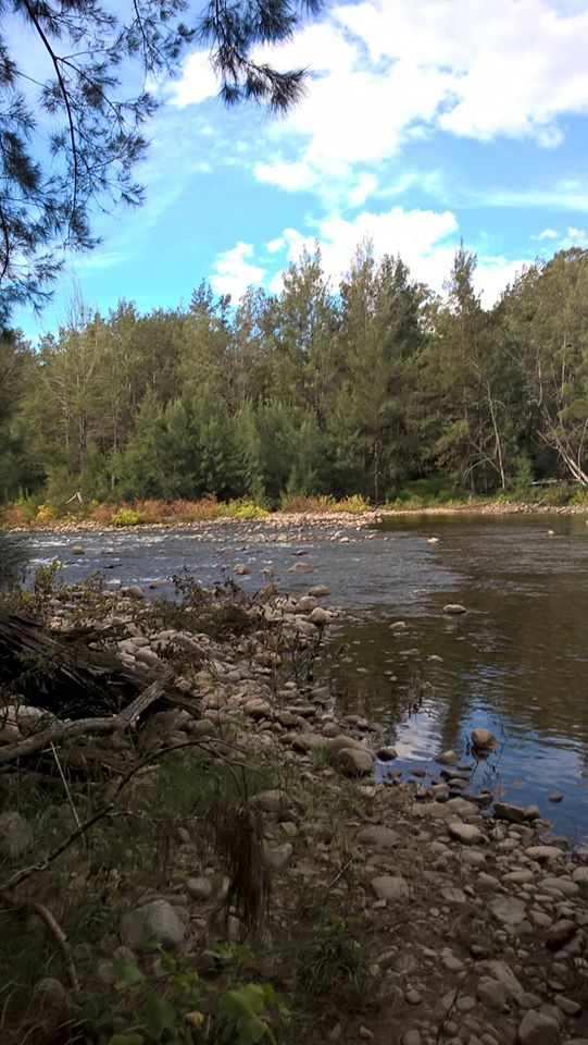
I set off at 6:30am. The feature of this day was to be a pretty punishing descent into Hellgate Gorge followed by an equally brutal slog back up the other side. It took 2 hours to walk down the ver steep firetrail and I paused for a coffee break after a painful shoes-off crossing of the Jenolan River. It is a nice spot and I filled up with water again. I know that the sewage treatment plant at Jenolan Caves flows out into this river (and eventually into Sydney’s water supply), but I’ve seen the outflow and it looks clean and clear. Anyway, I drank this water untreated without ill-effects.
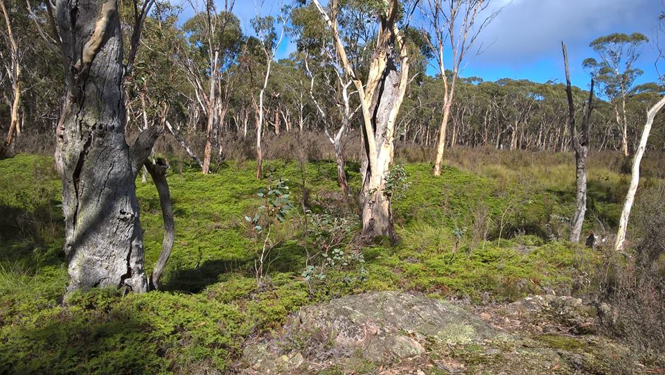
It took about 3 hours to climb out of the gorge to the undulating plateau far above. I passed through areas that obvioulsly were once cleared for farming. There were remnant of old fences about but trees are gradually reclaiming the place. It was here that I had my first wild pig encounter of the walk. I was listening to an audiobook as I walked so smelt them before I saw anything. A strong smell, then a sense of movement and there not far behind me was a huge sow and a gaggle of piglets. I understand they can be quite aggressive if they feel their babies are threatened, so I was keen to keep well clear of them. It was only the first of many pigs I saw over the walk, lots more that I ever have before. My impression is they are getting worse and it is becoming an infestation. Rumour is that some hunters actually release them and encourage the population. Fuckwits.
I camped just up the hill from Sally Camp Ck, there being no clear spots near the water. Besides, around the creek felt a bit too piggy for comfort.
Day three: Uni Rover Trail
26km; 339m up, 1229m down
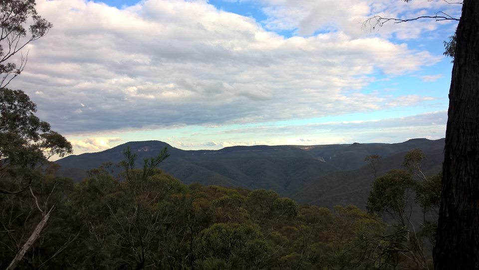
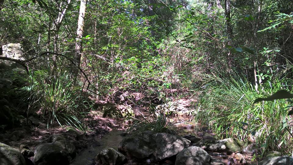
I set off again at 7am. This day I walked via firetrails to near the Boyd River, then onto Kanangra Walls Rd, past Boyd River campsite. I took some water from the river there, but wasn’t encouraged by the toilet paper everywhere. I treated it and hoped for better later on. Next it was onto Morong Ck firetrail, closed to traffic, and then the Uni Rover trail. It was my first time on the Uni Rover. It had long been a tantalising dotted line through the wilderness and now here it was. The trail is named after the Sydney University Rovers who marked the route in the early 60s. There is still evidence of tree blazes. More recently someone has marked much of the way with tin tags. There is a track for some of it but about half of the 15km north of the Kowmung River has no track at all. Even the markers run out too. So, despite looking like a track on the map (and it even appears on tourist maps where it is marked as a firetrail), it is just a route along the ridges and no track at all. South of the Kowmung it is even less, no track, no markings and hardly a route.
I got clean water from Wheengee Whungee Ck, and navigated my way south to the Kowmung River. The last half hour featured a double battle with a steep slope down and thickets of aggressive thorny bushes. Scratched and weary I set up a late camp by the Kowmung on a pleasant grassy patch.
Day four: Lannigans Ck
9km; 616m up, 128m down
This day started at 7am with a chilly shoes and pants-off crossing of the waist deep Kowmung River. It was disconcerting to see a big pig on the far bank that saw me and didn’t care. Curiously this one looked like a domestic type pig rather than the usual black hairy brutes. It was 7:30 before I started walking after drying off and pfaffing about with shoes and socks etc.
I didn’t really know what to expect here. Maps show the Uni Rover trail continuing along the banks of Lannigan’s Creek. As far as I could see, however, there was hardly even a viable route along the scrub-and-thorn-choked banks. Strangely I could find very little detail about this route online before
the walk, either it is rarely used or some kind of secret. One description of a return walk along the North side mentions a possible short excursion along Lannigan’s Ck to see Colong Caves. Either the author has never walked it or there is some track out of sight that I missed. Let me make it clear here: there is no easy route along Lannigan’s Ck other than splashing along through the water. It took me an hour or so to give up on trying to keep my feet dry and just go in the shallow water. I made slightly faster time when I did that, but it wasn’t long before I badly twisted my ankle and had a few minutes thinking “oh shit” and “I hope I’m not fucked”. Luckily, I was able to hobble along slowly on it but it hurt. It improved as it warmed up again, but made me seriously reconsider ever doing solo off-track walking in remote places again. With the rough going it was a slow day and short in terms of km. I averaged about 1.5km/h along the creek, not unusual for off-track walk. It was a beautiful creek, though a piggy one.
It was about 3pm before I finally made it to Acetylene Spur, the steep 300m climb out towards Batsh Camp. Batsh Camp was, apparently, originally called “Batshit Camp”, named by workers who carried bat guano from Colong Caves up the hill. The campsite was mercifully deserted; it is easy to drive there from Oberon.
During the night my ankle was really sore. After I cooled down, I couldn’t walk or stand without a stick. I was very worried.
Day five: Millnigang ridge
43km; 1288m up, 1291m down
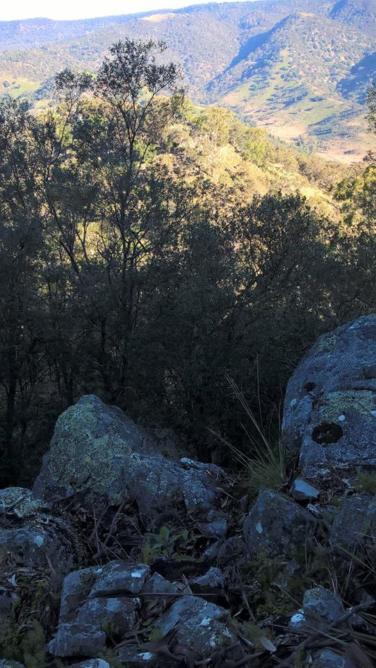
This long day didn’t go to plan. It started well enough at 7am. After warming up and some ibuprofen, my ankle didn’t hurt at all, and I made good time speeding along the Colong Stock Route dirt road and then the Millnigang Firetrail. As I walked the latter down its ridge I thought “this would be a bastard to walk up!”. It turns out that it was a bastard to walk up, a few hours later when I had to backtrack. I had planned a cunning route out of the mountains. A short off-track climb down the end of Millnigang Ridge to a ford over the Wollondilly and then rural tracks to Wombeyan Caves Rd. I got to within about 200m of ‘freedom’, but was defeated by little cliffs at the end of the ridge. Given more time and a smaller pack I could have searched for a safe way around; I know others have done it. But I was not confident and didn’t feel safe. I decided the best option was just to suck it up and make a very long detour via the Colong Stock route and the usual bushwalker’s corridor through the Lake Burragorang exclusion zone. This added an extra 50km to the walk.
At 4pm I turned around, scrambled back up the ridge, slogged back up the trail and made camp next to the Colong Stock route at 9:30pm.
Day Six: Wolloldilly
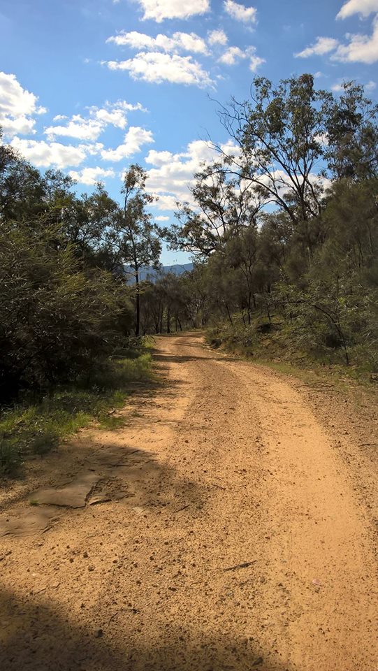
52km; 1396m up, 1465m down
This was a long day! I started at 7:30am and walked along the dirt road towards the Yerranderie-Sheepwalk Drive junction. Loads of veicles, mostly 4wds, passed me along here. Most were heading out. One little convoy of trucks with hunting dogs headed towards Yerranderie.
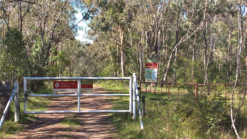
At about 2:30 I was well inside the restricted area when I noticed a cyclist coming up behind me as I trudged up a hill. He was pushing his bike but moving quickly. Bikes are banned from that area, and access is over locked gates with big signs spelling that out, so I was a bit surprised to see him. Only a bit, though, because I know that it is still a popular MTB route. I assumed he’s catch up, there’d be a couple of slight pleasantries, and then he’d ride off. But no..
He was following a GPS and it told him to come this way, but, he said, by the time he found out about the exclusion zone, it was too late for him to turn around. He didn’t have any maps, just a phone GPS app, and apparently hadn’t done any research about his trip. He planned to head towards Picton and had decided that if he walked his bike he’d be ok. Except that going to Picton involves going through the most exclusive of the exclusion zone. It turns out that it could have been an expensive trip for him had he gone ahead. We’d just crossed the Wollondilly at 3:30pm when a Sydney Water 4wd appeared at the other side of the ford. It crossed, passed us and stopped just up the road. It was followed by a convoy of about 10 more 4wds.
“you’re lucky that I’m with them today” he said to us, “because normally I’d be fining you $350” for having the bike. I wondered who “they” were. It looked like a group of his friends, unless it was an official organised tour. Either way, why is it a problem for MTB to use that trail but okay for 10 trucks? It seems that it was a once-a-year escorted trip for former or descendents of residents of Yerranderie. Yerranderie, once a silver mining community, is now a ghost town isolated in the national park and cut off from Sydney by the water catchment area.
I advised the rider to follow me up Wanganderry Pass. I had no desire to climb up Belloon Pass, the legal route. I didn’t want to be off track again and my ankle, while not painful, was very swollen.
On phone GPS apps, for some reason, the fire trail up Wanganderry pass is not shown. The cyclist couldn’t see it, but was reassured when I showed him on my maps and my real adult Garmin GPS. We walked from the edge of the exclusion zone to the bottom of Wanganderry pass. I didn’t mind walking with the cyclist, he was friendly enough and the company was nice, especially with pigs and howling wild dogs about.
I stopped for dinner at 8:30pm. The cyclist said he didn’t want to eat, but I suspect he had actually run out of food. He just had a couple of energy gels left. He didn’t want any of my food, not that I had much left either.
The track up Wanganderry pass is very, very steep, a 30% grade and was tough going. We reached the top about 11:30pm. Confident the cyclist could now find his way out on marked roads, I bid him farewell and camped at the carpark at the top. He rode on to Mittagong to get the 4:30am train.
Day seven: Bowral
32km; 361m up, 435m down
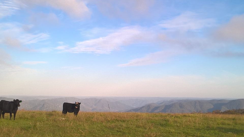
A 7am start for the 31km ‘road bash’ to Bowral. The first 5km was along Wanganderry Rd, a pleasant dirt road through an idyllic pastoral landscape with spectacular views of the surrounding bush. After that it was 25km along Wombeyan Caves Rd. Not much traffic, but with no shoulder and a 100 km/h speed limit, not ideal for walking. Amazingly, on the whole walk, only one driver beeped a horn at me, and that was when I was sitting away from the road on the Old Hume Hwy, and no one yelled anything.
I got to the end of my Katoomba to Bowral walk about 2pm, and kept walking around town another km. First stop was the bakery. Good. Then, because I both felt disgusting and reeked, I got some deodorant, wet wipes (for a ‘bath’), and a clean t-shirt and hoodie from Target, as a courtesy to fellow train travellers. Having emerged fresh from the bush and looking filthy, I must have looked a sight. I certainly got some uncomfortable looks from the genteel folk of Bowral: stupid little pissants some of them looked, poncing around trying to live out pathetic fantasies of grandeur. Even if some of them are grand, no need to act like a dick.
4:08 train back to Sydney via Macarthur, back home by 7. Swollen ankle, a bit sore; lots of blisters, but a good week’s walking. It took about a month before my ankle was more or less ok again.