This began as a “straightforward” long walk of 138km from Mittagong to Katoomba along mostly dirt trails. What should have taken around 40 hours turned into a weekend epic, and quite an adventure. It involved landslides, floods, feral animals, hallucinations and even a light plane flight.
The aim was to walk nonstop from Mittagong station to Katoomba station, 138km. Left Mittagong very early Saturday morning. Starts with 31km along roads to the edge of the Nattai national park, west of Hilltop. At the top of the fire trail down into the valley, far below, is an old warning sign saying it is closed to all due to landslide. Of course I ignored that as being for tourists…but bloody hell, the whole middle section of the track is peppered with huge rocks fallen from above, many extremely recent. I’d honestly think twice about going that way again. As it was I tiptoed along as quick as I could, keen not to trigger my own untimely end.
Effects of lots of rain clearly evident in the Nattai valley: river much higher than normal, and scrub and weeds massively overgrown. Who knew that cobbler’s pegs could grow taller than a person? Also the creek from the top of Belloon pass, normally dry, was running strongly all the way to the top of the pass.
Over the pass the route follows a special walkers corridor through the water catchment (deviate from the route and you can be fined $11,000). The rough track turns into service roads leading to a ford over the Wollondilly river. Just before the river, I startled a wild cow which lumbered off into the bush. The river was high and running strongly, but not too dangerous to cross very slowly and carefully, with the aid of a sturdy stick for extra support against the current. This ford is 50km into the walk.
Next it is another 20km to the ghost town village of Yerranderie, once the site of many silver mines now just a couple of houses , a caretaker and a small lodge, and an airstrip. Got there about 10pm, and stopped for “dinner” (half a ziplock bag of pretzels) and a 1 hour sleep lying on top of a picnic table. It was very chilly.

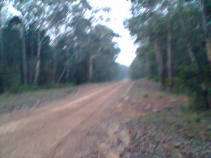
After Yerranderie is 40km along Scotts Main Range firetrail to Mount Cookem. It seemed endless. As I was getting pretty sleepy, I paused for another power nap by the side of the road, for about an hour. That helped and I made good time to the top of Mt Cookem ready for the steep climb down to the Kowmung and Coxs rivers, far below.
At this point things went wrong: the rivers were in flood, and there was no way across, obviously suicidal even to try. Only another 8-10 hours on to Katoomba, but just impossible to get there. By this time it was dark again, Sunday evening. I had almost no food left, no camping gear and most of my stuff was wet from the rivers (I knew it was suicidal to attempt a crossing, mainly by attempting a crossing). My safest option was to climb back up Mt Cookem and backtrack another 10km to New Yards where I knew the catholic bushwalkers club kept some huts, one of which was left unlocked for emergency use.
As I turned away from the raging torrent of the Kowmung, I was startled to come face to face (face to rump, really) with a BIG wild pig. It stood still, and let out a deep, rumbling grunt. I clapped my hands, and made a bit of noise hoping it would run away rather than attack! Luckily, it moved on, though hardly seemed panick-stricken. It went it’s way, and I went mine, as quickly as I could.
By now I was pretty sleep-deprived, and started making mistakes (apart from considering crossing the rivers). I decided to climb up via a different ridge, which quickly turned cliffy. I pressed on – don’t know why – reasoning that the scrambling and climbing would get me up faster. Finally, I admitted that this was stupid and leading to a potential dead-end, so I climbed back down about 400m before retracing my steps (and the track) from earlier.
It was very late, after midnight, as I stumbled along the track back to New Yards. I was so sleep-deprived by this point that I was hallucinating, falling asleep as I walked and often weaving drunkenly from side to side.
Made the hut about 2:30am (Monday) and slept until noon. Wore the spare thermals and fleece I’s carried in a dry bag, and my hooded rain jacket to sleep. Also used a “space blanket” – they really are warm.
It was nice to sleep for so long, but also meant it was too late to try walking up to Kanangra Walls in the hope of hitching a lift out with someone. Wouldn’t make it before night. I was able to get phone reception, so called NPWS in Oberon for the number at Yerranderie. Spoke to Scott, the caretaker, and explained I’d be walking back down there and my situation. He didn’t sound pleased.
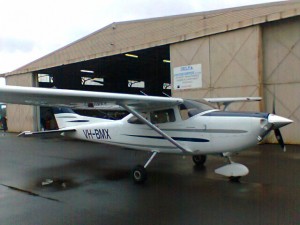
Turns out, however, that about 5km into my excruciating treck back along the endless 30km fire trail, a 4wd with Scott in it turned up and gave me a lift back. Brilliant! Back at Yerranderie we called Curtis Aviationat Camden, and they were able to send a plane out to get me so I could be back home Monday. It took 20 minutes for them to fly out and use that landing strip. 20 minutes and $250 later I was back in Sydney after having enjoyed a rare view of the Wollondilly valley from the air.

Cab to Campbelltown station, train back home in time for early dinner, only about 24 hours later than I’d planned, and easily able to make work the next day. Didn’t make it as far as Katoomba, though still walked about the same distance, around 120km. About 50 hours or so of walking, not all fast but valuable time on my feet nonetheless. Could have gone badly, but instead turned into a most excellent adventure.

